|
Updated Information
|
Date |
Camp Site or Accommodations |
GPS |
Distance Today:
419km |
Meals
Rubber chicken with sauce |
Weather |
Near Mpulungu, Zambia
Witt & Jen |
24 August, 2004 |
Tanganyika Lodge |
08°46.879’S x 31°04.845’E |
Odometer: 34049km |
Sunny, 96(F)
degrees |
|
We left the hot springs this morning at about
930 headed for Lake Tanganyika, although we weren’t sure if we’d make it
that far. Our first stop was Kasama where we found an ATM machine that
worked! We had lunch of chicken with nshima (meile pap) at a local
restaurant (for about four dollars including drinks) We’re getting better
at rolling the nshima into little balls like the locals do. After lunch we
filled up with diesel, which is getting more expensive the farther north
we go. It now costs a dollar per liter, which explains why there is almost
no traffic on the roads between towns. This is the most we’ve paid for
fuel since leaving the UK. We visited the shoprite where we were able to
find most of what we wanted in the way of food. After a stop at the bottle
store for gin we left town, at about 230. The road north was fair with a
few potholed sections to keep drivers on their toes. We dropped down from
the plateau we’ve been on at about 1700m into the rift valley. The view
would be quite spectacular were it not for the haze from the fires. We
reached a sign-posted turnoff for the lodge and started down a dirt track
which got progressively worse until we were crawling over rocks and
through washouts in low range. The lodge, when we finally arrived, is set
on the lake and we watched fishermen rowing ashore for the evening as we
enjoyed sundowners. Charity, the manager, said we could get curried
chicken with rice for 20,000 kwacha, so we opted for that rather than
cooking. We ordered at about 6pm and she told us it would take about an
hour. At 830 the food arrived. Charity explained that she couldn’t find
the cook, who has the keys to the kitchen where the curry powder is kept.
So we had some of the toughest chicken I’ve ever tasted in some sauce with
rice. The cheap silverware was no match for the chicken and we resorted to
tearing bits off with teeth. We nevertheless enjoyed a nice evening
listening to the waves crash on the shore. |
|
Updated Information
|
Date |
Camp Site or Accommodations |
GPS |
Distance Today:
650km |
Meals
Chicken |
Weather |
Pennington,
South Africa
Graham & Connie |
24 August, 2004 |
Venter Household |
30°22.907’S
30°41.345’E |
Odometer: 44616km |
Sunny, 75(F)
degrees |
|
Got up early, bid Bev farewell, and made our
way back to Durban. We stopped in Pietermaritzburg for a late lunch and
then at the Pavillion to check email and check in with Shiela on shipping
preparations.. Between Durban and Pennington we had another flat tire, and
as we had left one of the spares in Pennington, we called Krissy and Slade
who mounted a quick rescue operation. Back in Pennington, we started to
get everything packed up for the trip back. |
|
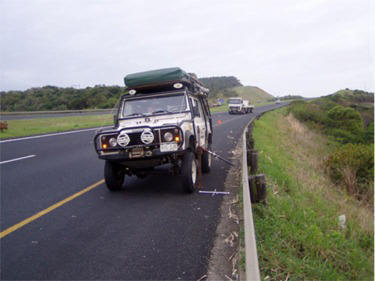
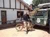
The last flat tire of the trip |
|
Updated Information
|
Date |
Camp Site or Accommodations |
GPS |
Distance Today:
155km |
Meals
curried beef with potatoes |
Weather |
50 km East of Mbala, Zambia
Witt & Jen |
25 August, 2004 |
bushcamp |
09°07.641’S
x 31°34.502’E |
Odometer: 34204km |
Sunny, 98(F) Degrees |
|
Last night was much warmer
than we’ve experienced for awhile, due to the low elevation of the lake.
Witt spent a couple of hours in the morning tightening the hubs on the
left rear. Not sure why they keep coming loose. The half-shaft on that
side is showing the same signs of wear that Nick pointed out on the right
in Livingstone. Unfortunately we don’t have a spare for that side. Charity
pointed us in the direction of an easier road out. It was better, but
still 4WD only. With it’s roads in disrepair and misleading signs, the
lodge definitely seems to have seen better days. We drove through Mbala to
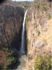
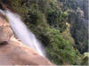
Kalamba falls, arriving at about lunchtime after more four-wheeling. The
falls are the second highest single-drop waterfall in Africa at 220m
(twice the height of Vic falls). Abraham, the “keeper” of the National
Monument, showed us around. The stream that feeds the falls represents the
border between Zambia and Tanzania. We left at about 3pm and after
stopping for fuel in Mbala drove about 10 miles south, then turned east on
the Mbala-Nkonde road. A sign at the turnoff proclaimed that the road had
been the subject of a “rehabilitation project” which gave us hope. The
project unfortunately must be a few years old, as there are large ruts
caused by trucks using the road during the rainy season. We drove for
about 35km before locating a suitable bushcamp in a disused quarry. We
asked (using signs) a toothless old man sitting in the shade if it was
alright to camp there. He said it was okay and watched as we set up our
camp and began preparing dinner. He got bored after awhile and we cooked
and ate undisturbed. |
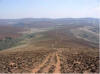
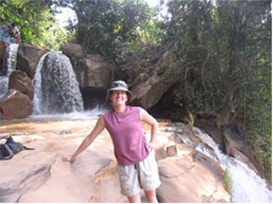
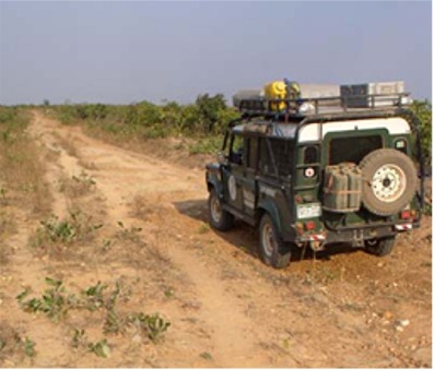
The Zambia/Tanzania border

|
|
Updated Information
|
Date |
Camp Site or Accommodations |
GPS |
Distance Today:
194km |
Meals
Chops |
Weather |
Pennington,
South Africa
Graham & Connie |
25 August, 2004 |
Venter Household |
30°22.907’S 30°41.345’E |
Odometer: 44809km |
Sunny, 75(F)
degrees |
|
Another early start. This time
we had to drive into Durban to drop the carnet off with Shiela. That being
done, we went to the Gateway shopping centre to check on some stuff and
have lunch. On the back towards Pennington, we stopped at the airport to
buy tickets to Johannesburg and pick up the tickets that Tracy from
Pangaea had purchased for us back to England. |
|
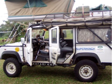
Getting cleaned up and ready to
ship |
|
Updated Information
|
Date |
Camp Site or Accommodations |
GPS |
Distance Today:
283km |
Meals
Ramen and leftover curry |
Weather |
|
12km west of Chitipa, Malawi
(in Zambia)
Witt & Jen |
26 August, 2004 |
bushcamp |
09°42.216’S x 33°10.040’E |
Odometer: 33487km |
Sunny, windy, 95(F)
degrees |
|
The toothless old man was back this morning.
He was still smiling and laughing a lot, but also he was asking for money.
We gave him 2000 kwacha for letting us stay and got on the road. We
arrived in Nkonde at about noon and checked out of Zambia. The immigration
official tried to talk us out of using the Chitipa road, saying that it is
nearly impassible. The only other way into Malawi from here is through
Tanzania, and we don’t fancy spending another $100 on a visa just to drive
through. We head back out of town the way we had come in and after
stopping to use the well in a school yard (causing great amusement) turned
left toward chitipa at about 1pm. We stopped for lunch soon afterward and
were nearly run down by a couple of white Jehovah’s Witnesses in a Toyota.
The track was good at first but as we neared the Malawi border it
deteriorated into a rutted mess. It had been a real, surfaced (with mud)
road at one point, probably during colonial times. We didn’t see many
suitable bushcamps, so at about 5pm we asked some locals if we could camp
on the football pitch near a village. They said OK, and we pulled in fully
expecting an audience. They arrived quickly and after some hellos and
handshaking, Jen and I sat in the car reading, with the windows rolled
down hoping that this was boring enough that they would go away. There
were about 20 people watching us and occasionally asking for things; Food,
money, shirts, whatever. It felt to us as though they didn’t see us as
people, rather as traveling goodie dispensers. I explained to one of them
that I couldn’t give him anything to eat because I didn’t have enough to
feed the whole village, and that it didn’t look likely that we’d eat
either. He seemed to understand and gathered up all the little kids (the
adults had left by this point) and headed back to the village. Not sure
how long the peace would last, we made some instant noodles and reheated
last night’s leftovers for a quick meal. In retrospect I wish I had a
soccer ball (and knew how to play). This may have broken the ice with them
and maybe allowed them to see us as real people.
There seems to be far too many white people
in Africa trying to change Africa. Nearly everywhere we’ve been people
have expected us to give them things. One possible explanation is that in
most African cultures there exists a sort of cultural socialism in which
someone who has something is expected to share it with friends and
extended family. Driving a car (and being white) marks us as very wealthy.
This social trait evolved to maximize chances of survival in a harsh
environment. The other (and in my opinion more likely) reason is that
there are so many aid organizations (run mostly by whites) giving out
stuff in Africa that Africans have come to believe that they are
perpetually in need and that white people are there to alleviate that
need. We’ve thought about this subject frequently during our travels, but
of course there are no easy solutions. |
|
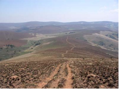
The "road" to Chitipa |
|
Updated Information
|
Date |
Camp Site or Accommodations |
GPS |
Distance Today:
103km |
Meals
Chops & Potatoes |
Weather |
Pennington,
South Africa
Graham & Connie |
26 August, 2004 |
Venter Household |
30°22.907’S 30°41.345’E |
Odometer: 44912km |
Sunny, 75(F)
degrees |
|
Connie and I spent the morning packing the
truck up and getting it washed. We had a 2pm appointment at the docks to
load into a container. At around noon we left for Durban, following Krissy
and Slade who had done this all before with David and Nadine. At the
docks, the process was pretty straightforward. We had to take the tent off
the top of the car to clear the door of the container, but it was pretty
easy. After strapping it in and sealing it up, we said farewell to Toki.
Hopefully we will see her in Denver in about 6 weeks!! Then it was back to
Pennington for some relaxing. |
|
|
|
Updated Information
|
Date |
Camp Site or Accommodations |
GPS |
Distance Today:
185km |
Meals
Boerewors with pasta |
Weather |
Niyika National Park,
Malawi
Witt & Jen |
27 August, 2004 |
Chilinda Campground |
10°35.097’S x 33°47.957’E |
Odometer: 34672km |
Sunny, 74(F) Degrees |
|
Last night we brought all of
our breakfast stuff into the tent with us in case there were people
gathered around the car in the morning. There was no-one when we got up,
so we sat on the top of the car eating our cornflakes and watching the
sunrise. We picked up a guy to whom we had offered a lift into town
yesterday and were on the road by 7am. We had driven the worst of the road
yesterday and arrived at immigration in Chitipa before 8. Our passenger
set off on foot from there. The immigration officer was friendly and
jovial, giving us advice on things to see and do in Malawi. After
completing the formalities we pored over a map for awhile pondering our
route. We have food and fuel for a few more days, so we decided to take
the back road into Nyika Park, avoiding the motorway. Jen suggested that
we pick up a young woman with a baby who was looking for a lift. It turned
out she was trying to get home to Nthalire with 5 thirty-five kilo sacks
of maize and a bag of potatoes. We hoisted all this onto the roof rack,
Anistasia climbed inside with her child, and we headed off very slowly,
the rear suspension groaning under the weight. When we dropped her off an
hour later she introduced us to her father and helped us locate some bread
to purchase. She even offered to pay for the ride! Shorly thereafter we
stopped for lunch and entered the park at about 230. Fortunately Malawian
parks are more reasonably priced, costing $25/day for us and our car. As
we started up the plateau, Witt noticed a low tire, our second in as many
days. We put on our second spare and continued on. We climbed almost 1000
meters to the top of the plateau where it was noticeably cooler. The
landscape is beautiful with broad vistas of rolling green hills and grey
rock outcroppings. We checked in at the campsite where the attendant built
us a fire and lit the donkey for hot showers. After dinner we sat around
the fire for warmth against the chilly breezes. |
|
|
|
Updated Information
|
Date |
Camp Site or Accommodations |
GPS |
Distance Today:
44912km |
Meals
Beef bobotie |
Weather |
Somewhere over Africa
Graham & Connie |
27 August, 2004 |
Nationwide Airlines Flight 9 |
? |
Odometer: 44912km |
Sunny, 75(F)
degrees |
|
Our final day in Africa.
Krissy and Slade took us to the airport and we had a final coffee together
there. Then we said our goodbyes and thanked them for all their help and
hospitality. Then it was into the plane for a flight to Johannesburg. Once
there, we called John and he came to pick up his phone and we said goodbye
to him and Carmen. Then onto the plane and off to England. Connie had a
flight booked back to Colorado, and Graham was planning on going back to
Downton for a couple of weeks.
Final Note:
And that is the end of Connie
and Graham’s contribution to the Africa Overland story. Thank you all very
much for your attention and interest. Witt and Jen, as you know, are still
on the road and still having adventures. Keep up with them on this site.
Goodbye and cheers. Graham Jackson & Connie
Rodman |
|
Updated Information
|
Date |
Camp Site or Accommodations |
GPS |
Distance Today:
45km |
Meals
Mexican beef with rice |
Weather |
|
Niyika National Park, Malawi
Witt & Jen |
28 August, 2004 |
Chilinda Campground |
10°35.097’S
x 33°47.957’E |
Odometer: 34717km |
Cool, windy, partly cloudy,
72(F)
degrees |
|
We brought the extra sleeping
bag into the tent last night and were glad to have it. We awoke to a
cold, swirling wind and clouds. We decided to hike today instead of
renting mountain bikes as we had planned. After dropping the two spare
tires off at the lodge’s shop, we drove out to the trailhead for the
highest point in the park (2600 meters). We saw some roan antelope, some busbuck and reedbuck, and a few zebra on the drive. The walk took us only
a couple of hours, and we had lunch back at the car before driving back to
camp where we spent the afternoon relaxing in the sun and reading. We
picked up our spare tires, repaired as promised. It got chilly at night
again and we were glad of a fire. |
|
|
|
Updated Information
|
Date |
Camp Site or Accommodations |
GPS |
Distance Today:
212km |
Meals
Vegetable curry |
Weather |
|
Near Livingstonia, Malawi
Witt & Jen |
29 August, 2004 |
Lukwe permaculture camp |
10°35.132’S
x 34°07.601’E |
Odometer: 34929km |
Partly cloudy 84(F)
degrees |
|
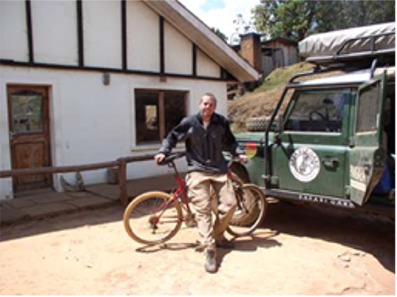
This morning’s weather was a
repeat of yesterday, and after breakfast Jen decided that it would be more
enjoyable to sit by the warm fire in the lodge than to mountain bike, so
Witt rented a bike and headed out, spending about 3 hours riding, which
was more than enough for his out-of-shape legs. The scenery was stunning
and it was somehow different to see antelope from the saddle of a bike.
The area would make for some excellent longer rides. Back at the lodge we
made lunch, and after stopping to do a short nature walk we headed out of
the park. At Rumphi we decided to take the tarmac to Livingstonia rather
than the scenic back way. The tarred route was by no means dull, as it
wound down the plateau to the lake shore. The road to Livingstonia,
however, climbed steeply up a rocky road and it was after dark by the time
we reached the campground. We did see the full moon reflected beautifully
in the lake as we climbed. At the campground we met Robert (British) and
Grace (Brazilian) who had shipped their Land Rover from Ghana to Durban
and are now headed back up the east coast. We exchanged stories and talked
until about 10. We decided to take our chances again with the restaurant
food, and Robert (the camp site manager, not the British guy) cooked us an
excellent vegetable curry. |
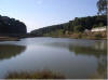
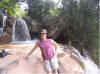
Lake Malawi from the escarpment
|
|
Updated Information
|
Date |
Camp Site or Accommodations |
GPS |
Distance Today:
0km |
Meals
Boerewors and baked potato |
Weather |
|
Near Livingstonia, Malawi
Witt & Jen |
30 August, 2004 |
Lukwe permaculture camp |
10°35.132’S
x 34°07.601’E |
Odometer: 33590km |
Partly Cloudy 94(F)
degrees |
|
We spent until noon today
talking with Robert and Grace (www.challengingyourdreams.com), and
checking out each others’ cars. After they left we walked to the nearby
Machwe Falls where we gave Andrew, a 7 year old boy, 15 kwacha (15 cents)
to show us around. He seemed like a good kid and was fun. We spent the
afternoon sitting on the deck of the unoccupied chalet reading and writing
website updates. |
|
|
|
On to August 31 - still in Malawi.. |