|
Updated Information
|
Date |
Camp Site or Accommodations |
GPS |
Distance Today:
134km |
Meals
The
Old House restaurant for lunch, braai’d boerewors for dinner |
Weather |
Kasane,
Botswana
Witt & Jen |
22 July, 2004 |
Ngima Camp |
17°47.396’S x 25°13.318’E |
Odometer: 28633km |
Sunny, 85(F)
degrees |
|
Jen made breakfast this morning while Witt
completed the repair job. We were on our way by 10am and were in Kasane in
time for a late lunch. I enjoyed an enormous hamburger while Jen had spare
ribs in the back garden of a pleasant restaurant in town. We spent the
afternoon catching up on emails and doing some shopping. We spent the
night at Ngima camp, a rather deserted place a few km out of town. Tony
and Helen, another couple who came down the west coast of Africa a month
after us, joined us at the campground and we spent the evening talking
about our experiences. |
|
Updated Information
|
Date |
Camp Site or Accommodations |
GPS |
Distance Today:
266km |
Meals
Ostrich kababs and filet over mash |
Weather |
Mokolodi Nature
Reserve,
Botswana
Graham & Connie |
22 July, 2004 |
Mokolodi Nature Reserve
campsite |
24°44.963’S
25°48.257’E |
Odometer: 37547km |
80(F) Degrees |
|
Last day in the desert. In the morning we made
a brief trip around Khutse Pan I and saw jackal, ostrich, secretary birds
and giraffe. We then headed out of the park to Gaberone. Just outside the
park I put out final 20 litres of diesel into the tank, and by the time we
filled up in Molepolole, we had pushed 1300km since fueling in Maun. In
Gaberone we had lunch at the mall, then spent some time at the internet
café catching up. Plans are afoot for shipping our car back to the States,
and those details have to be ironed out. Our original plan had been to
stay at Saint Clairs Lions camp where we have stayed before, but we
decided to stay at Mokolodi Nature reserve instead, and it was a wise
decision. Only 12 km out of Gaberone, Mokolodi offers great game viewing,
as well as a lot of educational programs. We had dinner at their fine
restaurant and had hot showers in camp after lighting a fire under the
donkey. |
|
Hot Showers! |
|
Updated Information
|
Date |
Camp Site or Accommodations |
GPS |
Distance Today:
129km |
Meals
Buffet at the Chobe Safari Lodge |
Weather |
|
Kasane,
Botswana
Witt & Jen |
23 July, 2004 |
Ngima camp |
17°47.396’S
x 25°13.318’E |
Odometer: 28762km |
Sunny, 85(F)
degrees |
|
Today is our third wedding anniversary, and we
were hoping to be at Victoria Falls to celebrate it, but since the timing
didn’t work out we decided to spend an extra day in Chobe rather than
traveling. We spent the morning on a game drive through the northern part
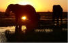
of the park, seeing hippos, elephant, and a couple of baboons mating.
After a nap in the afternoon we went back to town and filled our jerry
cans (fuel in Zambia is reported to be expensive) and met our sunset
“booze cruise” on the Chobe river. It was very relaxing and very
beautiful. We brought beers and snacks and were well prepared to enjoy
ourselves. The highlight was approaching very close to a group of elephant
and having the sun set behind them. After we backed off, two of the group
swam across the river in front of us, their trunks held up out of the
water like snorkels. After the cruise we went to the Chobe Safari Lodge,
an upscale place on the river, for a great dinner. We even tried grilled
mopane worms, a feature of the local diet, but weren’t all that thrilled
with them. We spent the rest of the evening talking with Tony and Helen at
camp. |
Black-backed vultures and ??? arguing over the remains of a buffalo Monkey (or rather baboon) business Our afternoon's boat ride We watched a group of elephants having their evening drink Our heroes, leading their life of hardship and constant toil

Black-backed vultures and ??? arguing over the remains of a buffalo
|
|
Updated Information
|
Date |
Camp Site or Accommodations |
GPS |
Distance Today:
537km |
Meals
Left over filet and mash |
Weather |
|
Kimberly, South Africa
Graham & Connie |
23 July, 2004 |
Big Hole Caravan site (for
half), Beside N12 highway (for half) |
28°44.386’S
24°45.121’E |
Odometer: 38083km |
75(F) Degrees |
|
We did an early game drive in Mokolodi and saw
a bunch of warthog. Then crossed the border into South Africa again and
made our way down as far as Kimberly. We had some trouble finding the Big
Hole Caravan park. The Big Hole is easy enough to find, being the biggest
hand dug hole in the world and in the center of town. On finding the
caravan park we discovered that the people who run the place had left for
the day. We set up camp and then made some phone calls, and while we were
on the phone two boys tried to break into our car. Connie saw them by the
car and Graham chased them, and luckily they didn’t get anything. We moved
the car to the other side of the park, and decided to turn in.
Unfortunately one of the other tenants decided to stay up all night
playing very loud music. By just after midnight we had had enough, and
decided to leave, but that’s the next day! |
|
Mokolodi |
Just before the attempted break
in! |
|
Updated Information
|
Date |
Camp Site or Accommodations |
GPS |
Distance Today:
98km |
Meals
Camp restaurant |
Weather |
|
Livingstone,
Zambia
Witt & Jen |
24 July, 2004 |
Zambezi waterfront camp |
17°15.220’S
x 25°50.665’E |
Odometer: 28860km |
Sunny, 89(F)
degrees |
|
We left the campground at about nine this
morning, planning to cross into Zambia and stay a place outside of
Livingstone called Kubu Cabins, where we intended to celebrate our
anniversary. We cleared customs on the Botswana side, then went to the
Kazangula ferry, arriving at about 1030. The ferry crosses the Chobe river
where Namibia, Botswana, Zambia, and Zimbabwe all meet in the water.
Almost as soon as we arrived the ferry stopped running, having broken
down, or the crew stopped for lunch or whatever. There was a queue of
vehicles and it was after 330 when we finally got on the ferry. We spent
the time sitting in the car and reading, or talking with other tourists in
line. Getting off the ferry on the other side it was clear we were back in
Africa proper. There was much confusion and running around. We located the
customs building and bought a 3-year multiple entry visa for $40 each. The
Zambian Customs wasn’t interested in our carnet and gave us a temporary
vehicle import permit instead, for which there was no charge. We went to a
yellow shipping container nearby which served as the office for the state
insurance company and purchased the obligatory 3rd party liability
insurance for about $6 for a month. When we finally got on the road we
passed a long line of trucks waiting to board the ferry. It was clear they
would wait for days. We couldn’t find the entrance to Kubu Cabins, and
drove into Livingstone to camp at Zambezi Waterfront instead. The place is
a very large complex, including a hotel, campground, restaurant, and tour
company. It seems to be popular with overland trucks and there are loads
of drunk early-twentys aussies running around. We had dinner at the
restaurant overlooking the river and dropped into bed early after a long
day. |
|
 |
|
Updated Information
|
Date |
Camp Site or Accommodations |
GPS |
Distance Today:
553km |
Meals
Snails, steak and chicken |
Weather |
Karoo National Park, South
Africa
Graham & Connie |
24 July, 2004 |
Campsite, Karoo National
Park |
32°19.954’S
22°29.507’E |
Odometer: 38636km |
Raining, 75(F) Degrees |
|
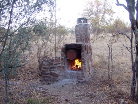
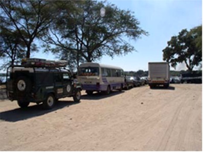
Left the Big Hole caravan park just after
midnight, and headed south. At about 5am we stopped by the side of the
road for some rest. At 7:30am we carried on, and got to the Karoo National
Park at about 9:30. We checked in, signed up for the 4x4 trail and then
had lunch. Afterwards, we headed out on the 4x4 trail which climbs up the
escarpment. The Karoo is quite barren and harsh, and the main wildlife in
the park are dassies whose closest relative is the elephant. We also saw
mountain zebra, klipspringers and ostrich. While climbing up the
escarpment road, the rear suspension started making some drastic sounds.
The sort of sounds that signal imminent failure! One of the rear tires
also started loosing pressure. So we headed back to camp and Graham
changed the tire. During the change he also discovered that the rear
bottom spring mount on one side was tearing itself off the axle. Another
flaw with the Safari Gard suspension it seems. The spring mount was
cracked most of the way off. Graham decided to keep an eye on it since no
welder was close by. It only becomes an issue at full drop on the rear
suspension, something that shouldn’t happen on regular tar roads. It may
even last until we reach home. After changing the tire we went to dinner
at the park restaurant which was very pleasant, and then turned in. |
|
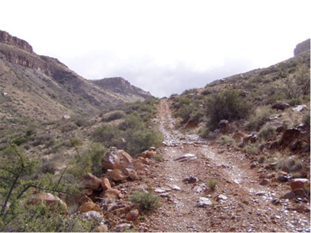
Climbing onto the escarpment |
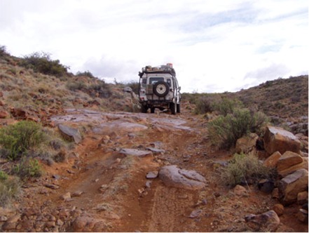
Not the best place to discover
suspension problems! |
|
July 25 --- > |


 business")