|
| |
|
Updated Information
|
Date |
Camp Site or Accommodations |
GPS |
Distance Today:
162km |
Meals
leftover pasta |
Weather |
|
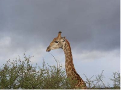
Kruger National Park, South
Africa |
27 October, 2004 |
Belule camp |
24°03.396’S x 31°44.033’E |
Odometer: 40998km |
Cloudy 78(F)
degrees |
|
It stayed cloudy and a little
rainy all morning. We didn’t see much in the way of animals and we spent a
couple of hours during the day reading and writing website updates. We
went to Balule camp for the evening. Balule is what is known as a “bush”
camp in Kruger. There is no grocery store, petrol station, or electricity.
Hot showers and flush toilets are of course still available. The camp is
much smaller than the others we have stayed at and we enjoyed watching
hyenas prowl the perimeter fence near our camp. |
|
|
|
Updated Information
|
Date |
Camp Site or Accommodations |
GPS |
Distance Today:
306km |
Meals
beef stir-fry |
Weather |
|
Near Graskop, South Africa |
28October, 2004 |
Aventura Blydespoort |
24°34.717’S x 30°46.518’E |
Odometer: 41304km |
Sunny, 96(F) Degrees |
|
This morning we saw a group of
about 7 hyenas lounging on the road near a baboon they had killed. After
watching them sleep for awhile, we left the park and drove into the Blyde
River Canyon area which is supposed to have some good hiking. We stopped
at the information center and booked accommodation at two huts along the
trail for the nextg two days. We checked in at a corporate mega-resort
aimed mostly at tour busses. It wasn’t quite to our taste, but we made the
best of it, enjoying sundowners on their restaurant patio overlooking the
canyon. |
|
|
|
Updated Information
|
Date |
Camp Site or Accommodations |
GPS |
Distance Today:
37km |
Meals
Leftover beef stir-fry |
Weather |
|
Near Graskop, South Africa |
29 October, 2004 |
Watervalspruit Hut |
Not Recorded |
Odometer: 41341km |
Sunny, 92(F)
degrees |
|
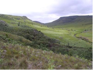
We left the car at Bourke’s
Luck Potholes this morning, planning to do a 3 day one-way hike in the
Blyde River Canyon. We boarded a minibus that took us to the trailhead
where we had lunch. We walked for only about an hour through beautiful
rolling grassy hills to reach the first hut. The hut is not as nice as
those on Mt. Mulanje, but we have the place to ourselves, and the
caretaker had left firewood for us. We found a nice pool in a nearby
stream to bathe in. After a beautiful sunset, we cooked our dinner over
the fire. We threw the sleeping mats onto the lawn and crawled into our
bags as we watched the full moon rise into scattered clouds. |
The huts aren't much to look at...

|
|
Updated Information
|
Date |
Camp Site or Accommodations |
GPS |
Distance Today:
14km |
Meals
Salmon Curry |
Weather |
|
Near Graskop, South Africa |
30 October, 2004 |
Clearstream Hut |
Not Recorded |
Odometer:
41355km |
Cloudy, 84F) Degrees |
|
Sleeping outside, we awoke at
first light. After breakfast we set off for the next hut. Our hike took us
through some beautiful country that reminded us of New Zealand with it’s
vivid green rolling hills. We arrived at the hut at about 1230. After
lunch Jen did some bird watching (and spotted five species she hadn’t seen
before) while Witt napped in the sun. At around 5pm, a group of four South
Africans arrived, and we talked with them as we prepared our dinner. Rain
was threatening so we elected to sleep inside the hut. |
|
 |
 |
|
Updated Information
|
Date |
Camp Site or Accommodations |
GPS |
Distance Today:
75km |
Meals
Chinese restaurant |
Weather |
|
Graskop, South
Africa |
31 October, 2004 |
Graskop Holiday resort |
24°55.922’S x 30°50.798’E |
Odometer:
41430km |
Sunny, 88F) Degrees |
|
We set off a little later this
morning after talking with the South Africans for awhile. The trail
followed the Teure River for awhile, but the scenery wasn’t as nice as the
previous two days. Forestry is big here (we would later learn that we were
in the midst of the largest man-made forest in the world) and the
evergreen forests are pretty aside from the fact that all of the trees are
lined up in nice neat rows. We lost the trail at one point and spent about
30 minutes locating it again. We stopped for lunch on a rock in the river
and arrived back at Bourkes Luck at about 230. We bought some cool drinks
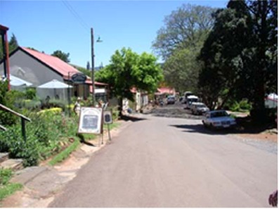
and headed to Graskop. In the evening we walked into town, which felt
exactly like what it was: A tourist town in the off-season on a Sunday
night after everyone had driven back to Joburg for the week. We had
trouble locating an open restaurant and finally ended out in a pub where
we started talking to Garret and Maggie, a couple from the nearby village
of Pilgrims Rest. They invited us to join them for dinner at a Chinese
place around the corner. Garret and Maggie have so much energy that it’s
exhausting just being around them. They interrupt each-other and jump from
topic to topic faster than the five oclock news. Their two teenaged sons
are even worse. They would sit down and start talking, only to interrupt
themselves by jumping up and dashing out of the restaurant on some unknown
errand. They invited us to come to visit them at Pilgrim’s Rest tomorrow,
and to stay for dinner, an invitation which we appreciated and accepted
with some trepidation. |
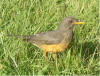
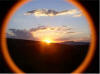
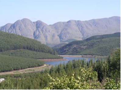
I finally got to see a dung beetle doing it's thing today! The view onto the lowveld from God's Window

I finally got to see a dung beetle doing it's thing today!
|
|
Updated Information
|
Date |
Camp Site or Accommodations |
GPS |
Distance Today:
50km |
Meals
Baked potatoes |
Weather |
|
Sabie, South
Africa |
01 November, 2004 |
Jock's Lodge |
25°05.871’S x 30°46.631’E |
Odometer:
41480km |
Sunny, 87(F) Degrees |
|
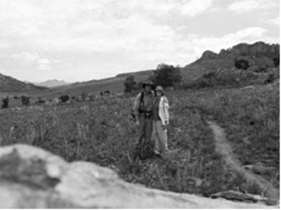
Pilgrim’s Rest is like the
little towns in Alaska on the cruise ship itineraries. The local
population is about 150, all of whom depend upon the bus loads of tourists
that arrive every day to disgorge their souvenir-buying and lunch-eating
cargo. A former gold mining town, Pilgrim’s Rest is a string of 1900s era
buildings spread out along a road along the hillside. The town will host
the world gold panning championship next year. Garret spent the morning
taking us around town, introducing us to the locals. “This couple is from
America. They’ve driven all the way through Africa! We met them last night
in Graskop.” The locals were friendly, but as is usually (and
understandably) the case, they didn’t want to spend the energy getting to
know another tourist who is just going to get back on the bus (or Land
Rover) and leave after an hour. After buying Garret lunch we headed out of
town. I had heard there was some good mountain biking in Sabie, so we
stopped there at about 230 and spent the afternoon in the internet café.
When we returned to our car, we found a note on the windshield saying,
“Hi, I’m from Colorado Springs!” We eventually found the author who turned
out to be a 70 year old lady who has been living in South Africa for the
past 40 years. We also met a Dutch couple after pointing out a low tire on
their hired car. We all got together for a few drinks and talked for a
couple of hours. The US presidential elections tomorrow are a hot topic.
Apparently 90% of the Belgian population supports Kerry. I found it
interesting that we had a conversation with Dutch people about American
politics while I couldn’t even describe the structure of the Dutch
government. |
|
Pilgrim's Rest |
|
Updated Information
|
Date |
Camp Site or Accommodations |
GPS |
Distance Today:
43km |
Meals
Haute Cuisine |
Weather |
|
Sabie, South
Africa |
02 November, 2004 |
Sabie Backpackers |
25°05.590’S
x 30°46.726’E |
Odometer:
41523km |
Sunny, 90(F) Degrees |
|
The Dutch couple’s tire was
flat this morning, so after breakfast we put some air in it for them so
they could drive it to a tire shop rather than dealing with the spare. The
bike rental place in Sabie is moving locations and things were a bit
hectic as we tried to sort out our bikes. We got underway at 1030. The sun
was hot as we followed a dirt logging road out of town. After an hour or
so we started to climb steeply. We ran out of water and contemplated
turning back. We pressed on and finally made it to the paved road and the
promised restaurant. We ordered lots of Coke and water. The lunch menu
looked very nice indeed. We started with springbok capriccio, followed by
a trout fillet for Jen and a trout/feta/spinach quiche for Witt. We shared
a crème brulee for desert as we enjoyed the view over the valley from the
restaurant’s patio. With a full stomach and sore bums, we decided we
weren’t up for the 22km ride back to town, so we phoned the bike shop and
asked them to come and collect us, which they had offered to do. Chantel
arrived about 30 minutes later in her tiny blue pickup truck. We threw our
bikes in back and headed to town. We had snacks for dinner that evening
and went out with Linda searching for glowing mushrooms. I think you have
to smoke some of these mushrooms before you can actually see them, and we
didn’t see any. We stayed up late talking with Linda and her finance
Woody. Woody happens to be the son of Jack, one of the South Africans we
met while hiking in Blyde River Canyon a few days ago. He grew up in a
town inside Kruger National park and shared some amazing wildlife stories
with us. |
|
Updated Information
|
Date |
Camp Site or Accommodations |
GPS |
Distance Today:
143km |
Meals
Grilled T-bone, salad |
Weather |
|
Near Barberton, South
Africa |
03 November, 2004 |
Bushcamp |
25°52.034’S
x 31°04.231’E |
Odometer:
41666km |
Sunny, 92(F) Degrees |
|
After saying goodbye to Linda
and Woody this morning, we drove south to Nelspruit. It’s time to buy
airline tickets home. We stopped at a travel agent in a flashy mall
outside of town. The travel agent found us decent fares to Philadelphia on
December 9. As a little bonus, we get to spend two days in Amsterdam on
our way home. It’s strange knowing that our trip has a set end date now,
and a little scary that it’s only five weeks away. We are looking forward
to seeing friends and family from home though. We finished with the travel
agent and had lunch, then went to an internet café to check on the
presidential elections. It’s still up in the air, but it looks like Bush
will come out ahead in the end. We looked at a map and decided to try to
make it into Swaziland rather than spend the night in Nelspruit. The
border we’ll be using is on a little dirt road and closes at four pm. Out
of Barberton, the road begins to climb steeply up a large mountain range.
With my foot on the floor in second gear, Rafiki started to overheat. As
the needle inched toward the red mark, I shifted back to first and we
crept slowly up the mountain. The road followed an areal tramway once used
to bring asbestos from a mine in Swaziland to Barberton for processing. As
we reached the top of the mountain range, the tarmac gave way to dirt and
we entered a beautiful area of green mountains flanked by pine forests. As
we continued to wind along the road, it became apparent that we wouldn’t
reach the border post before it closed at 4pm. Having seen few cars and
even fewer people, we decided to bushcamp. We pulled off on one of the
many forestry access roads and camped just below the main road, but out of
sight of it. Our campsite has a lovely view over a green, forested valley.
We built a fire and grilled a steak, enjoying the peace and quiet you can
only get bushcamping. As the daylight faded, the starts came out in all
their glory and we sat watching for meteors as the fire burned to embers.
|
|
 |
|
Updated Information
|
Date |
Camp Site or Accommodations |
GPS |
Distance Today:
174km |
Meals
Impala Stew |
Weather |
|
Mlilwane NP, Swaziland |
04 November, 2004 |
Sondzela Backpackers |
26°29.704’S x 31°11.740’E |
Odometer:
41840km |
Sunny, 94(F) Degrees |
|
Last night was wonderfully
quiet after the rumbling trucks at Sabie Backpackers the night before.
After breakfast (which included a quart of motor oil for Rafiki) we headed
to the swazi border. The South African side was deserted and the staff all
came out to have a look at our car. They were friendly and efficient and
we were soon on our way. The Swazi side was equally deserted and our
passports were processed quickly. A woman with a baby asked us for a lift
to the nearby town of Pigg’s Peak, so we cleared off our spare seat and
she climbed aboard. She told us about the history of the asbestos mine,
which closed in 2001, and showed us the empty workers’ housing complex and
a golf course quickly being overgrown by the bush. It was like a modern
ghost town. She was headed for the capital, Mbabane, which is where we’re
going as well, so we said we’d take her all the way. After dropping her
off in town,, we had some lunch in a park, then headed to a glass factory.
We were able to stand on a catwalk over the factory floor and watch
workers turn lumps of molten glass into elephants, lions, beer glasses,
and other useful objects. In the afternoon we drove the short distance to
Mliliwane National Park. We cooled off in the swimming pool at the
backpackers and spent the rest of the afternoon relaxing. Dinner was
offered for only 25 Rand each so we decided to enjoy the Impala stew
rather than cook. |
|
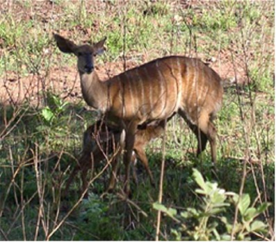
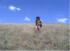
A bushbuck and baby |
|
November 5 ---> |
|